Project Jukebox Survey
Help us redesign the Project Jukebox website by taking a very short survey!

Bill Brosge, Part 1
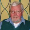
Bill Brosge was interviewed in his home in Woodside, California on September 23, 2004 by Karen Brewster, two days after his 83rd birthday. He worked as a geologist for the United States Geological Survey, Alaska Branch from the early 1940s until 2002 located at the Western Region Center in nearby Menlo Park, California. His mobility has been impaired by Parkinson's Disease, so he uses a walker to get around his house. In this interview, Bill talked about the early days of field geology, leading field parties and planning expeditions, the joys and hardships of fieldwork, changes resulting from the establishment of the Park, and creating the Arctic Quad geological map. On April 7, 2001, Bill Brosge received the Dibblee Medal for his achievements in geologic mapping in Alaska. The historic photographs that appear here in his slideshow were obtained from Tom Moore of USGS who put together a presentation for the awards ceremony (for more about the award and Bill Brosge go to http://www.diggles.com/wbrosge/index.html)
See also:
Digital Asset Information
Archive #: Oral History 2002-27-21_Pt.1
Project: Gates of the Arctic National Park
Date of Interview: Sep 23, 2004
Narrator(s): Bill Brosge
Interviewer(s): Karen Brewster
Location of Interview:
Funding Partners:
National Park Service
Parts:
Alternate Transcripts
There is no alternate transcript for this interview.
After clicking play, click on a section to navigate the audio or video clip.
Sections
1) When and where he was born, his geology education, and getting his first job with the US Geological Survey
2) Making topographic maps from photographs and using map making tools
3) J.B. Mertie's mapping expedition across the Brooks Range
4) His first job in Alaska testing permafrost at Cape Spencer
5) How he came to Alaska for permanent work
6) The 1951 expedition led by Bill Patton traversing the Brooks Range
7) 1950 field season and helicopter crash at Shainin Lake
8) Continuation of doing geological field work in the early 1950s, and use of tracked vehicles (weasel) for carrying out expeditions
9) What Umiat was like and early methods used to drill for oil
10) Studying the Lisburne limestone in the northeastern Brooks Range in 1952
11) The names of crewmembers on the 1950, 1951 and 1952 fieldtrips in the Brooks Range
Click play, then use Sections or Transcript to navigate the interview.
After clicking play, click a section of the transcript to navigate the audio or video clip.
Transcript
Section 1: birthdate\ birthplace -- Bronx, New York\ woods\ streets -- unpaved\ brother -- younger\ job -- US Geological Survey\ World War II\ education -- undergraduate\ Columbia University\ major -- geology\ Lobeck, Armand K.-- professor\ geology -- interest in\ physiography\ Columbia University Press\ maps -- publishing\ military service\ military -- rejection|
Section 2: job -- US Geological Survey, Alaska branch\ aeronautical charts\ aerial photographs\ camera -- cylindrical\ photograph -- 360 degree\ maps -- making of\ maps -- photographic\ maps -- topographic\ topographical mapping -- early methods\ perspective\ photography -- techniques\ aledaide\ angles -- measuring\ triangulation\ intersection\ adjustments\ aledaide -- description of\ telescope\ blade\ plane table\ tripod\ drafting paper\ aledaide -- use of\ map making -- in the field\ transit\ stadia rod\ measurement\ distance\ elevation\ level bubble|
Section 3: maps -- making of\ maps -- topographic\ topographical mapping -- early methods\ geologist\ plane table\ walking\ topographical mapping -- in the field\ map -- drawing\ Fitzgerald, Gerald\ US Geological Survey, Alaska Branch\ expedition -- mapping\ Mertie, J.B.\ Brooks Range\ Alatna River\ Howard Pass\ map -- looking at\ Killik River\ expedition -- geological\ travel -- dogsled\ expedition -- route\ travel -- canoe\ Colville River\ dogs -- killing of\ expedition -- split\ Ikpikpuk River\ Maybe Creek\ Barrow\ freeze-up\ Mertie, J.B. -- area covered\ Mertie, J.B. -- report\ Mertie, J.B. -- map|
Section 4: job -- US Geological Survey\ World War II\ airplanes -- fighter planes\ airplanes -- Lend-Lease Program\ Russia\ Alaska\ airplanes -- route\ Edmonton\ Whitehorse\ Fairbanks\ Nome\ Siberia\ Army Corps of Engineers\ airstrips\ permafrost -- evaluation\ Northway\ Galena\ Cape Spencer\ airstrip -- steel-mat\ equipment -- lack of\ Gates, George\ field season -- timing of\ project -- problems with\ Black, Bob\ equipment -- iron rods\ permafrost -- testing\ data -- recording\ permafrost -- mapping\ fresh water\ sandbar\ sewage\ World War II -- end of\ Russians -- leaving\ Alaska\ Women's Auxiliary Corps (WACS) -- Russian\ women -- stature of\ typhoon\ waves\ Nome -- waterfront destroyed\ whiskey -- loss of\ salt water -- infiltration of|
Section 5: job -- US Geological Survey\ job -- hired\ Washington, DC.\ job -- making maps\ Cape Spencer\ education -- graduate school\ Columbia University\ Virginia\ Cumberland Gap\ work -- fall\ work -- logging wells\ work -- mixing with school\ Miller, Ralph\ bulletin -- US Geological Survey\ Powell River\ geological -- theory\ Naval Petroleum Reserve\ Umiat\ job -- offered\ education -- quit\ Alaska -- arrival\ Maybe Creek\ Colville River\ Ikpikpuk River\ travel\ vehicle -- Weasels\ geology -- anticline\ mapping -- structural\ anticline -- closure\ testing -- seismic\ drilling\ well -- dry\ anticline -- description of\ oil -- accumulation\ oil -- behavior of\ gas -- behavior of\ oil -- holding\ spillway -- lack of\ work -- northern Alaska|
Section 6: Patton, Bill\ expedition -- Brooks Range\ vehicle -- Weasel\ Hunt Fork John River\ John River\ boat\ Umiat\ expedition -- route\ map -- looking at\ Okokmilaga River\ canyon\ Weasel -- mechanic\ Grady, Red\ travel -- steep slope\ money -- earned\ wolf -- bounty\ wolf -- paw\ Brooks Range -- experience|
Section 7: Shainin Lake (Kanayut Lake)\ helicopters -- use of\ Navy\ Alapah Creek\ camp\ Anaktuvuk Pass\ Lisburne limestone -- measuring\ Prudhoe Bay\ limestone -- porous\ formations -- limestone\ Lisburne limestone -- type section\ rock -- exposure\ helicopter -- Navy\ elevation -- effect of\ Patton, Bill\ helicopter -- crash\ lake -- candle ice\ Downs, John\ pilot\ Shainin, Vince\ rescue\ Shainin, Vince -- drowning\ Miller, Ralph\ Reiser, Hill\ Navy\ body -- retrieval|
Section 8: Navy -- off project\ geologists\ fly -- lake to lake\ walk\ airplanes -- float-plane\ camp -- moving\ accident -- effect of\ fieldwork -- geological\ military -- management of\ Shainin, Vince -- personality\ Shainin, Vince -- conflict\ geology -- fun\ field work -- types of\ travel -- weasels\ travel -- walking\ weasel -- advantages of\ tundra\ walking -- hard work\ weasel -- description\ pontoons\ weasel -- carry weight\ weasel -- river crossing\ weasel -- tracks\ weasel -- life-expectancy\ radio contact\ weasel -- controls\ weasel -- hand-brakes\ weasel -- gear shift\ weasel -- track marks\ Maybe Creek\ Umiat\ Navy\ weasel tracks -- follow\ weasel -- impact of|
Section 9: Umiat\ Umiat -- structures\ Quonset huts\ warehouse\ repair shop\ bunkhouse\ mess hall\ Umiat -- people\ Navy -- Seabees\ Barrow -- landing\ oil -- search for\ Barrow -- gas fields\ Umiat -- oil seep\ oil -- drilling\ wells\ oil -- lack of production\ permafrost\ drilling -- freezing\ freezing -- solution to\ Ruby, Bill\ cable tools\ drilling -- equipment\ cuttings\ bucket\ drilling -- mud\ drill -- rotary\ drilling -- tower|
Section 10: Brooks Range -- places\ Brooks Range -- northeast\ Arctic Wildlife Range\ Lisburne limestone -- studying\ travel\ airplane -- floatplane\ wildlife range -- planning for\ research -- specialists\ Bee, Dr.\ University of Kansas\ zoologists\ shotgun -- use of\ loon -- eating\ loon -- taste of\ Steer, Bill\ Bronx Botanical Gardens\ botanist\ archeologist\ specialist -- caribou\ Scotland\ Leopold, Starker\ specialist -- landscape\ camp -- life at\ garbage -- burning\ Walker Lake\ Helmericks, Bud\ gas -- borrowing\ camp -- Lake Peters\ Schrader Lake\ research station\ Sheenjek River\ Mangus, Marv\ Reiser, Hill\ camp -- moving\ airplane -- rough flight\ airplane -- Norseman\ specialists -- went home\ Umiat\ Mangus, Marv -- painter\ Anchorage|
Section 11: Maybe Creek\ trip -- crewmembers\ Kover, Allen\ Whittington, Charlie\ field assistants\ cook -- Dwornik, Steve\ moose -- shooting\ moose -- population\ party chief -- Brosge, Bill\ Brooks Range -- traverse\ trip -- crewmembers\ party chief -- Patton, Bill\ Mangus, Marv\ field assistants\ Hereid, Gordon\ Warren, Jack\ cook -- Olsen, Dick\ Shainin Lake\ trip -- crewmembers\ cook\ cook -- bull-cook\ Brosge, Bill\ Reiser, Hill\ Shainin, Vince\ field assistant -- Downs, John\ field assistant -- Gudim, Clair.J.\ geologist -- Wyoming\ names -- Yugoslavian\ Brooks Range -- south side\ Lisburne limestone\ rock -- schist belt\ rock -- viewing\ mountain\ North Slope -- subsurface|