Channel Changes Slide 10
| 10 of 25 | << First | < Previous | Next > | Last >> | Back to gallery |
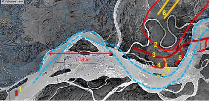
Human manipulations and changes in the Tanana River channel and the mouth of the Chena River.
Notes:
Then & Now: 1949 vs. 2013. 1. Island in Tanana River eroded away; 2. Access road for airport runway construction; 3. U.S. Army Corps of Engineers' dike; 4 & 5. U.S. Army Corps of Engineer's groins (11 total) protecting the airport; 6. South ends of runway and taxiway as of 1963; 7. Access road to gravel dragline quarry.
In 1949, the Tanana and Chena Rivers were about to be profoundly influenced by human manipulations: 1. Chena Slough cut off from Tanana River, became “Badger Slough, a clear-water stream; 2. Fairbanks was about to relocate the airport from Weeks Field to just north and east of this aerial view. The basic configuration of the Chena River was to join, as here, the main channel of the Tanana River right above the right hand end of the arrow showing a mile scale.
Satellite image from the Geodata Center, Geophysical Institute, University of Alaska Fairbanks.