Channel Changes Slide 11
| 11 of 25 | << First | < Previous | Next > | Last >> | Back to gallery |
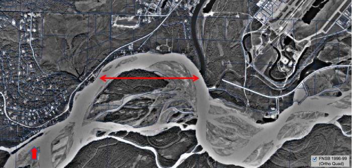
1996 Ortho Quad satellite image of the Chena-Tanana area.
Notes:
A 1996 Ortho Quad satellite image shows that the long narrow tree-covered island to the southwest of the old townsite of Chena is eroding away. Also note that the gravel pit first indicated in the 1963 topographic map persisted as a body of clear water, even though the U.S. Army Corps of Engineer's (USACE) most downstream groin had been built at its northern edge.
Satellite image from the Geodata Center, Geophysical Institute, University of Alaska Fairbanks.