Gil Mull Powerpoint Slide 22
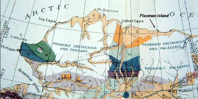
Description:
Location of Ernest deK. Leffingwell's camp at Flaxman Island used during his exploration of the coast and continental shelf. Marked on the First Geologic Reconnaissance Map of Alaska compiled by Alfred H. Brooks, 1904-1905.
 Listen to Gil Mull talk about this photo.
Photo Courtesy of:
Gil Mull