Channel Changes Slide 8
| 8 of 25 | << First | < Previous | Next > | Last >> | Back to gallery |
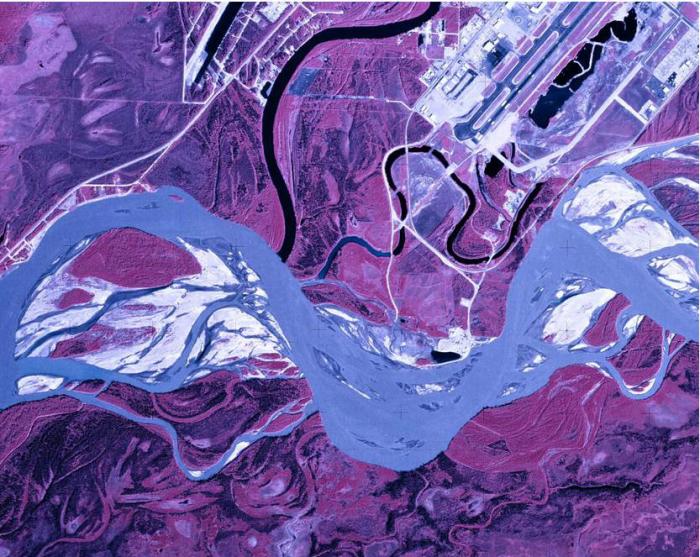
U-2 aerial image of mouth of Chena River and Tanana River, July 11, 1978.
Notes:
This aerial image (believed to be a U2 image and not a satellite image) dated July 11, 1978 is surprising, in that neither the U.S. Army Corps of Engineers’ main flood control dike, nor the groins built to divert active channels southward from the Fairbanks International Airport have been constructed. Yet the gravel dragline pit on Morgan Island has become a substantial clearwater pond by 1978 (black oval area at top of S-curve of the Tanana River). Image AR638002300147, courtesy of Alaska High-Altitude Photography (AHAP) program, which was a state and federal partnership to acquire consistent aerial coverage over Alaska. NASA Johnson Space Center and NASA Ames Research Center aircraft were used to photograph the state between 1978 and 1986.