Channel Changes Slide 15
| 15 of 25 | << First | < Previous | Next > | Last >> | Back to gallery |
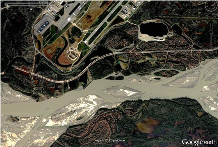
Google Earth image of Tanana River and end of Fairbanks Airport runways, September 11, 2012.
Notes:
Google Earth image dated September 11, 2012 showing Fairbanks International Airport and East Ramp General Aviation runways and the U.S. Army Corps of Engineers' (USACE) last 5 groins (of 11 total). Note drainage provision between airport complex and the USACE’s main dike (or levee), which may have been the source of a trickle of clear water running most of the winter season during the Dangerous Ice Project past the end of the main dike.