
Bottom of Peirce's Island Gallery
Date Observed: Mar 23, 2011
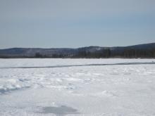 Open lead across the main channel of the Tanana River at bottom of Peirce's Island that is about 1/3 mile long. Processes Observed |
Knut Kielland describes an unexpected open lead that developed in late January in an unusual location. Processes Observed |
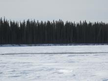 Open lead in mid-river at bottom of Peirce's Island that is about 50 feet across. Processes Observed |
 Fast current flowing through the open lead in the Tanana River at the bottom of Peirce's Island. Processes Observed |
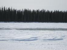
 Edges of the open lead at the bottom of Peirce's Island slowly re-freezing and forming shelf ice. Processes Observed |
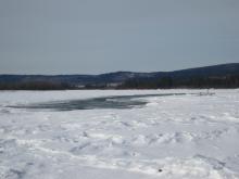
Sam Demientieff and Knut Kielland talk about how new areas of open water, like this one at the bottom of Peirce's Island, develop when you do not expect them, and they compare this one with the area seen in the previous year in front of Howard Luke's camp. Processes Observed |
|
Viewing whole length of the lead at the bottom of Peirce's Island, and listening to the sound of running water. Processes Observed |
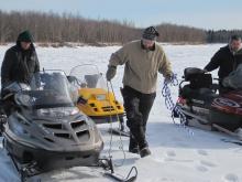 Knut Kielland prepares himself with a safety rope before walking to the edge of the lead at the bottom of Peirce's Island to test the ice thickness and water temperature. Processes Observed |
 Knut Kielland with his long-handled ice pick that he uses to test ice thickness before proceeding in uncertain conditions. Processes Observed |
|
Knut Kielland tests ice thickness with his ice pick and axe as he approaches the edge of the open lead. Processes Observed |
Knut Kielland measures the water temperature in the open lead at the bottom of Peirce's Island. Processes Observed |
Knut Kielland reports that the lead at the bottom of Peirce's Island is 7 feet deep, with an estimated 6 mph current, and water temperature of just at freezing. Processes Observed |
|
Knut Kielland discusses changes in the open lead at the bottom of Peirce's Island over the course of a month. Processes Observed |


