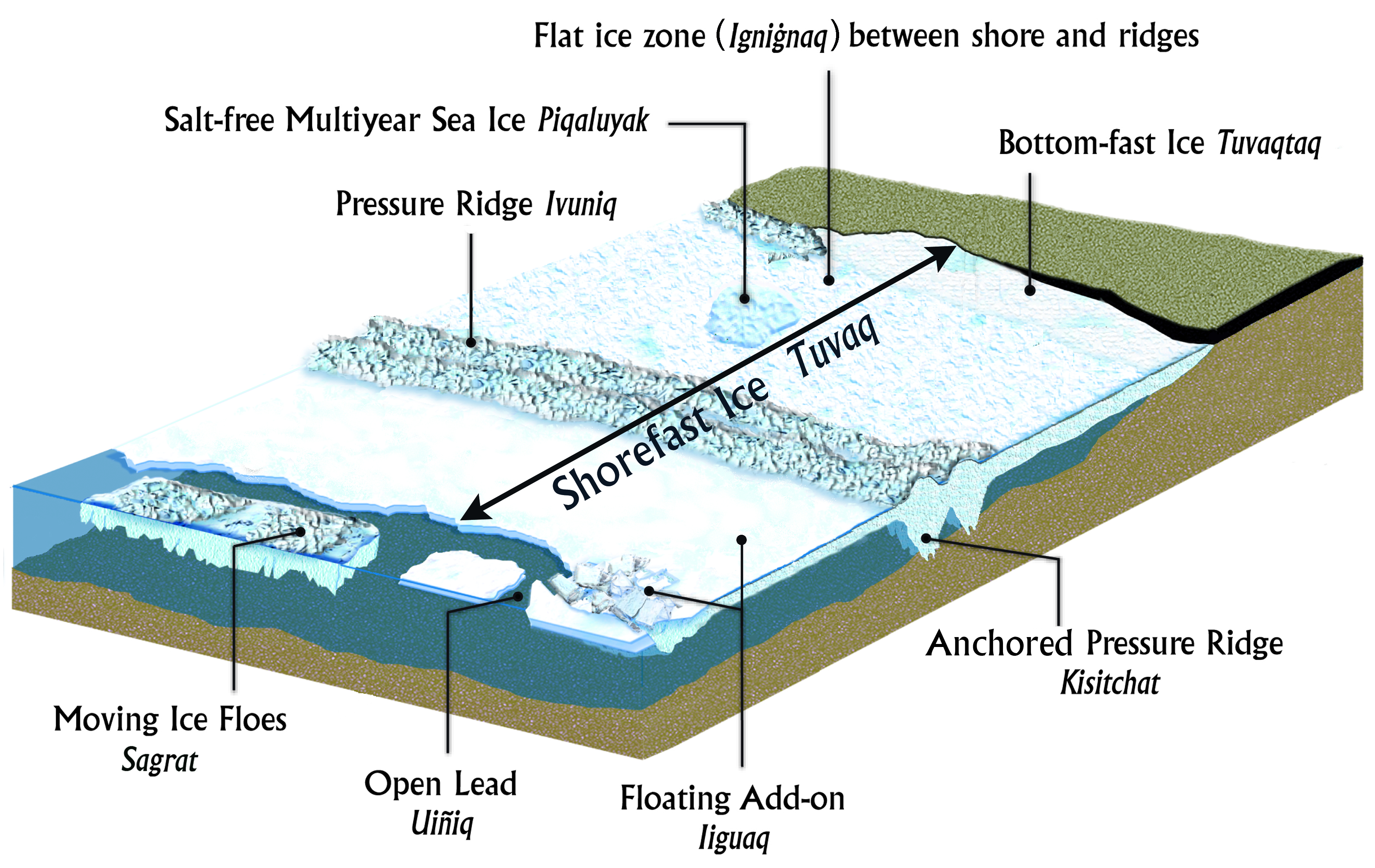
Schematic Representation of Coastal Sea Ice in the Chukchi Sea off Barrow, Alaska with English and Inupiaq terms.
Courtesy of Matthew Druckenmiller and Craig George, and modified with permission from an illustration by Deb Coccia. Originally appeared in“Alaska Shorefast Ice: Interfacing Geophysics With Local Sea Ice Knowledge and Use.” Matthew L. Druckenmiller. Ph.D. Dissertation, University of Alaska Fairbanks, August 2011, and in “Observations on Shorefast Ice Dynamics in Arctic Alaska and the Responses of the Inupiat Hunting Community. John C. “Craig” George, Henry P. Huntington, Karen Brewster, Hajo Eicken, David W. Norton, Richard Glenn. Arctic, Vol. 57, No. 4 (December 2004), pp. 363-74.

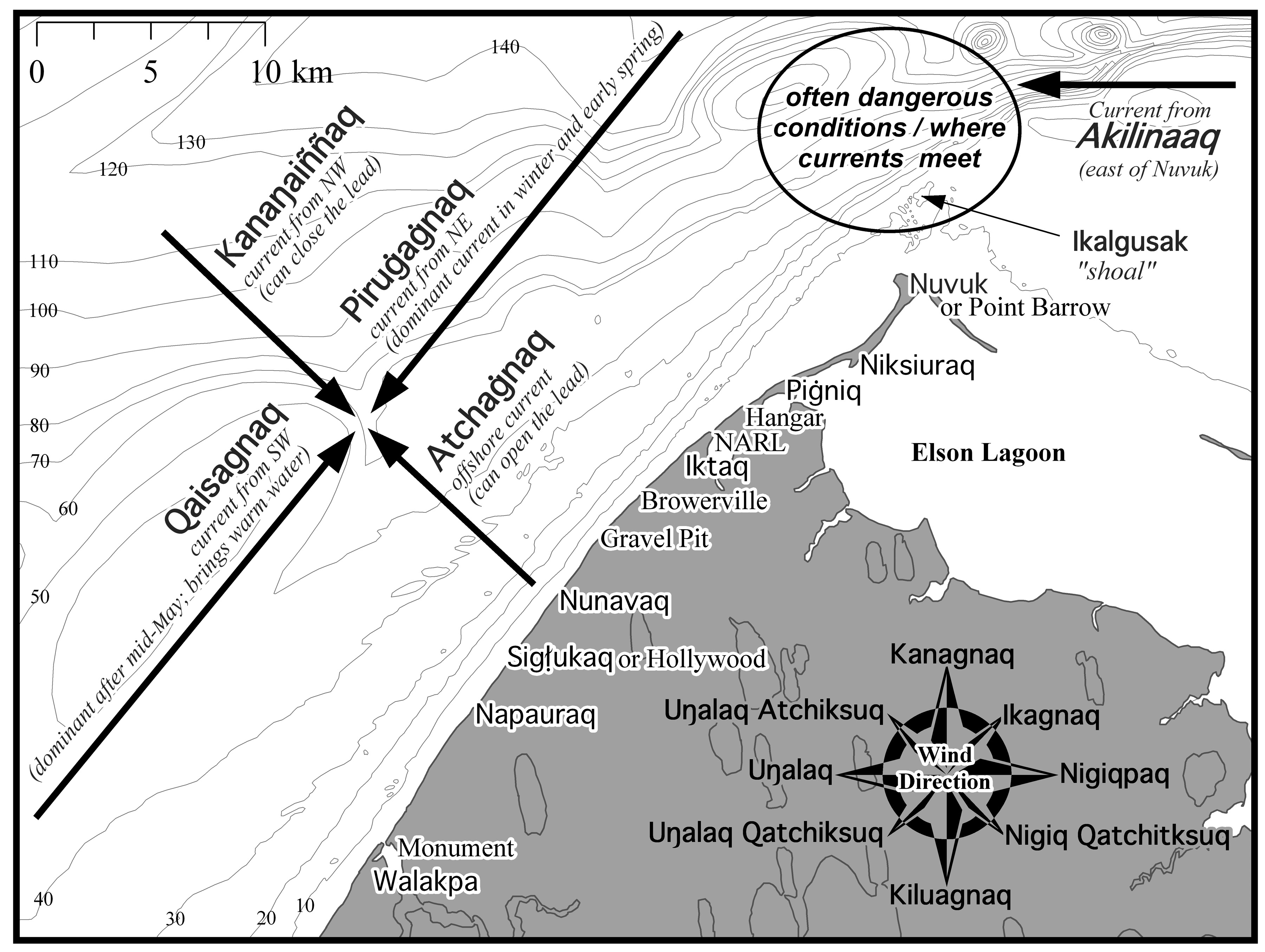
Traditional Knowledge of Barrow's Currents, Winds, and Ice Drift Directions.
A subset of the many traditional place names and other commonly used terms unique to Barrow are shown at locations along the coast. "NARL" refers to the site that was previously the Naval Arctic Research Laboratory. Bathymetry is shown as 10m contours. Courtesy of Matthew Druckenmiller.


